Above All - Ohio | Stock Photo of the Week Archive | 2012

|
2011: Archive | Slide Show |
2012: Archive | Slide Show |
2013: Archive | Slide Show |

|
|
|
|||||
|
|||||
|
|
|||||
|
Our photos look best when viewed on a properly calibrated monitor. While not a true calibration, a quick and easy way to get close is to adjust your monitor until you can see all eleven (11) distinct shades of gray in the image below. 
|
|||||
|
|
|
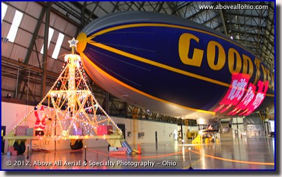
December 17-31, 2012
"Santa's Giant Sleigh" As if the United States Marine Corps Reserve doesn't do enough for this country, each year, they collect toys and distribute them to millions of children throughout the United States. The Toys for Tots program began in 1947. That Christmas, 5,000 toys were collected and distributed in California. Last year, nearly 16 MILLION toys were delivered to over 7 million children. (In each of the years of 2004 and 2006, over 19 million toys were distributed.) This year, for the third year, Goodyear opened up its blimp base near Akron, Ohio, in support of the program. For one weekend only, vehicles were allowed to drive through the decorated hangar, drop off their toy or cash donation, and wave to Santa as he leaned out from behind the controls of the blimp. To view a larger version of this photo, click on it or click this direct link. |
|
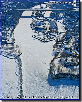
December 10-16, 2012 "Rocky River Becomes Icy River" The Cleveland Yachting Club's marina at the mouth of the Rocky River, west of Cleveland, Ohio, is frozen in this photo from January, 2011. Looking south into the winter sun, this photo almost appears balck and white (however, on this particular day, there wasn't much color in any direction...). The winter of 2010-2011 was much colder than last winter (2011-2012). Last winter, this area never froze over and Lake Erie remained virtually free of ice for the entire season. Will this year be a repeat of last year? Or will we get get hit with a more typical northern Ohio winter? Only time will tell, but we're hoping for another mild one! To view a larger version of this photo, click on it or click this direct link. |
|
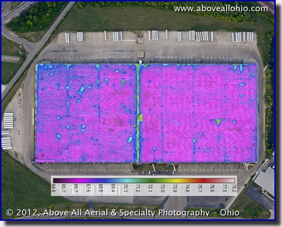
December 3-9, 2012 "Hidden Moisture" This week's photo is actually two images blended into one. The base image is a regular vertical photograph of an approximately 720,000 square foot building. The colorful overlay is a thermal infrared image of the roof acquired after sunset. The purpose of this hybrid image is to locate areas where moisture may be trapped in the roofing material. During the day, the sun heats up the roof (and the water trapped within it). After sunset, the moisture-laden areas cool at a slower rate than the dry areas. These temperature differences give us clues to where roofing problems may exist. Our certified thermographer must optimize the infrared image and interpret the results (as not all warm areas are necessarily due to the presence of water). Only then can we present our customers with a detailed report of our findings. To view a larger version of this photo, click on it or click this direct link. |
|
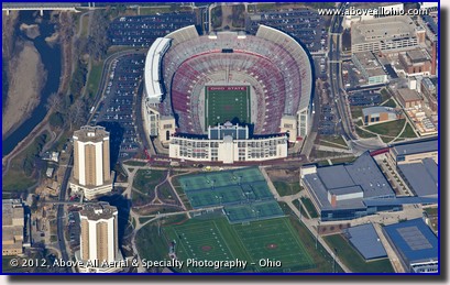
November 26 - December 2, 2012 "Empty Shoe" Last week, the Ohio State Buckeye's football team capped an undefeated season, ending with a record of 12-0. Unfortuantely, the end of the regular season was the end of the season completely for Ohio State. Due to NCAA sanctions, the Buckeyes were banned from any post-season games including the Big 10 Championship game and a potential National Championship bowl game. Ohio State fans are proud of the Buckeyes, but many feel about as empty as Ohio Stadium - "The Horseshoe" - looks a few days after the last 2012 game... To view a larger version of this photo, click on it or click this direct link. |
|
November 19-25, 2012
"Good Food" |
|
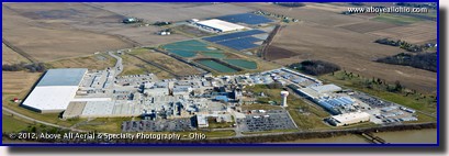
Last week, we featured a mall photo and had a Christmas-themed write up. It seems like the Christmas season starts earlier and earlier every year. This week, however, we'll back up and talk about something more appropriate for November -- this week is Thanksgiving in the U.S. It is a time to get together with friends and family and reflect on all of the things we are thankful for. Of course, it's also a time to eat! Along those lines, therefore, the subject of this week's aerial photo of the week is the gigantic, sprawling complex that is the Campbell's Soup factory located along the Maumee River in northwest Ohio near Napoleon. There are a few interesting things to point out in this photo. The two dark areas below and and to the upper right of the white building in the top center area of this photo are fields of solar panels which supply part of the electricity needed to run the plant. The plant uses enough water to warrant having its own water tower and water treatment plant both of which can be seen just right of center in the photo. Finally, near the left edge of the photo, the emergency fire water tank can be seen - it is painted red and white to resemble a giant can of soup! To view a larger version of this photo, click on it or click this direct link. |
|
|
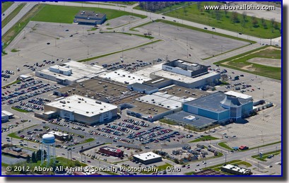
November 12-18, 2012 "Only 42 Days Left" As of November 12, there are only 42 shopping days left until Christmas! This aerial photo, taken early last March, shows the Richland Mall in Ontario, Ohio (near Mansfield). Little has changed since one of our photographers browsed for Christmas list ideas here as a young boy. The blue portion of the mall on the right (north) with the distinctive entrance was once a Lazarus department store. The chain merged with Macy's around 2005. Sears is visible at the upper left (south) and has been there as long as we can remember. The current Macy's store at the upper right (west) used to be O'Neils. The final anchor - JC Penney - on the lower left (east side) is a fairly new addition to the mall. Though most stores are already decorated and holiday commercials have already been airing, the traditional holiday shopping season doesn't kick off until next week with "Black Friday" - the day after Thanksgiving. Give us a call if you need help finding a place to park! To view a larger version of this photo, click on it or click this direct link. |
|
November 5-11, 2012
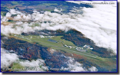
"Coming Home" The morning of November 1, 2011, was foggy in Coshocton, Ohio. A military jet carrying Raymond J. Border home from Afghanistan circled the field while a military honor guard, friends, and family waited on the ground. If you look closely, you can see several busses and a line of cars along the road. Shortly before this photo was taken, the fog cleared enough for the plane to land. We did not know what was going on below us when we flew by. Later we learned with much sadness that this was the scene of Chief Petty Officer Border's final homecoming. Chief Border had been killed in action less than 2 weeks before, on October 19, 2011. Chief Border, from nearby West Lafayette, Ohio, gave the ultimate sacrifice. We pause on Veteran's Day this week to say thank you to him, his family, and all of the other women and men in our armed forces and their families. Their dedication and sacrifice for this country and the people who live in it cannot be measured or understood, let alone repaid. You can read more about Chief Border on this page of the Coshocton Tribune newspaper's web site. To view a larger version of this photo, click on it or click this direct link. |
|
October 29 - November 4, 2012
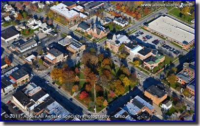
"Fall on The Square" This photo of "The Square" of downtown Medina, Ohio, was taken in the late afternoon of a late autumn day last year. The huge storm that was Hurricane Sandy that slammed the east coast was so large that it had caused downed trees, power outages, and building damages here in Ohio - over 400 miles away from New York. The winds reached sustained speeds of 40-50 MPH in Ohio (with higher gusts). The storm brought an abrupt end to what had been a very colorful and beautiful fall in a large part of the U.S. this year, as the winds stripped most of the remaining leaves from trees. To view a larger version of this photo, click on it or click this direct link. |
|
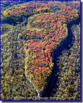
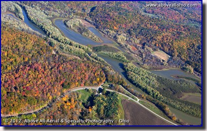
October 22-28, 2012 "Spectacular Ohio Fall Colors" The fall colors were so beautiful this year, we could not pick just one photo this week... Both of these photos were taken during Ohio's peak autumn color period last week. They were taken above the 837-acre Simco Wildlife Area just south of Coshocton, Ohio. The high walls of rock seen in the top image are not natural - they are the result of strip mining activities in the late 1960's. Ohio (and much of the rest of the country) had a mild winter last year, followed by an early, warm spring, and a hot, dry summer. These conditions were apparently favorable for the beautiful fall colors that we have all been seeing. We are very fortunate to be able to witness the change of seasons from the air and we hope you enjoy the small sampling of photos we have provided.
To view larger versions of these photos, click on them or click one of these
links:
|
|
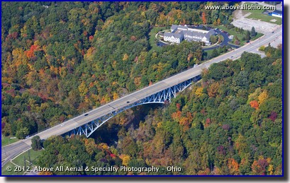
October 15-21, 2012 "High Level Bridge" This week's photo is the Main Street bridge in Cuyahoga Falls, Ohio. The so-called "high level bridge" spans the Cuyahoga River and a popular hiking trail appropriately called the Highbridge Trail. Although not part of the Cuyahoga Valley National Park, this area is heavily wooded and very pretty - especially in the fall, as you can see in this aerial view. This photo was taken a week or so prior to this year's peak color period. Just to the west of this bridge (off of the left side of this photo...) is the Cascade Valley Metro Park, which is part of the Summit County (Ohio) Metroparks system. The building north of the valley and west of the bridge (in the upper-right corner of this photo), is Sunrise of Cuyahoga Falls, a senior assisted living facility. To view a larger version of this photo, click on it or click this direct link. |
|
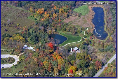
October 8-14, 2012 "Dressed Up for a Happy Anniversary" Spectacular fall colors can be seen in this aerial photo of the Alderfer-Oenslager Wildlife Sanctuary near Sharon Center, Ohio. This park, which is part of the Medina County Park District, is known locally as "Wolf Creek Park" because it is the home of the Wolf Creek Environmental Center. The center, which officially opened on October 7, 2000, has a classroom for presentations, a lab room for studies, and a glass-enclosed sitting area where people can relax and watch the birds outside or peruse one of the nature books from the small library. Many special educational events take place here all year long. They offer exceptional learning opportunities for children and adults alike. Many events are free while some programs charge a very small fee. To view a larger version of this photo, click on it or click this direct link. |
|
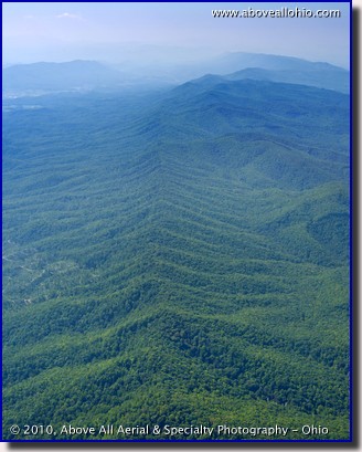
October 1-7, 2012 "Hazy Mountain Ridge" Every once in awhile we are able to work jobs together in such a way that we can provide service for our customers in areas that would normally not be cost effective for us to do ourselves. (See our service area and coverage map for an overview of how we can get photos of al of your sites, no matter where they are...) When the schedule works out in such a way that we are able to make longer than normal flights, we always take advantage of it to collect stock photos of the beautiful areas of our country that we fly over. On one such long trip, we had to opportunity to get some stock of the Appalachian Mountains and the Cherokee National Forest, which runs through the northeast part of Tennessee, southeastern Virginia, and western North Carolina. This aerial photo shows a ridge disappearing into the haze. Barely visible in the upper left corner of the photo is the town of Mountain City, TN. To view a larger version of this photo, click on it or click this direct link. |
|
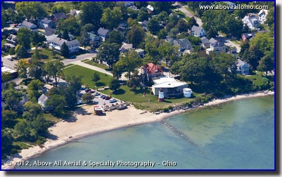
September 24-30, 2012 "Ohio Beach" Vermilion, Ohio, (pronounced but not spelled like "Vermillion"...) is home to The Great Lakes Historical Society and, until recently, the Inland Seas Maritime Museum. The (former...) museum can be seen in this aerial photo, just right of center. The museum is now permanently closed as it is in the process of moving to Toledo, Ohio. When it re-opens, the museum will be known as the "National Museum of the Great Lakes" and will continue to preserve historic artifacts and provide education about all of the Great Lakes (not just Lake Erie). The new museum will feature both indoor and outdor displays, a park, and access to the retired Great Lakes freighter, the S.S. Col. James M. Schoonmaker. To view a larger version of this photo, click on it or click this direct link. |
|
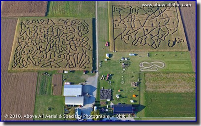
September 17-23, 2012 "Corn Maze Season" Ramseyer Farms, near Wooster, Ohio, is a popular destination for families all over Ohio in the months of September and October. They have many fun activities for kids of all ages, but the huge elaborate mazes are what stand out from the air. Every year, they feature the Ohio Corn Maze - seen here on the right. The Ohio maze features an educational scavenger hunt, teaching kids and adults alike a bit about Ohio's history, culture, and economics. The maze on the left changes from year to year - in 2010, when this photo was taken, they had an aquatic theme featuring shells, fish, an octopus, a dolphin, and a sea turtle. If you and your family want to see what they have this year, head out to the farm and spend a nice fall day with your family! To view a larger version of this photo, click on it or click this direct link. |

|
September 10-16, 2012
"Fall in Suburbia" This neighborhood outside of Columbus, Ohio, definitely opted for maximizing the space available to get as many units on the land as possible. The more or less uniform architecture is punctuated by the uniformly spaced (and colored) red maple trees. Densely packed developments such as this one sprung up all over the country several years ago. Small lots and minor design differences helped make new houses affordable and allowed a lot of people to buy brand new homes on a budget. Unfortunately, developments such as these also contributed to the glut of houses on the market... This photo was taken in November, 2011. Because of the early, warm spring and the hot dry weather that much of the nation has experienced, we anticipate the fall colors will peak early and the leaves will be off of the trees completely by November this year. If you need aerials with green leaves, you need to contact us right away! And if you want aerials with nice fall colors, don't wait until the middle of October - you will probably be out of luck! To view a larger version of this photo, click on it or click this direct link. |
|
September 3-9, 2012
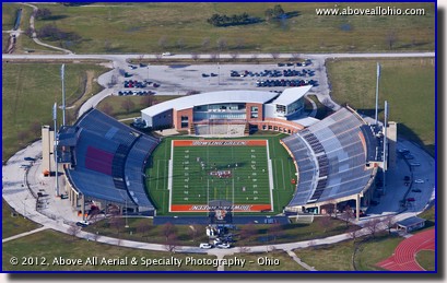
"Unseasonable Football" It's September and that means football is back! For the third week in a row, we are featuring an aerial photo with a football stadium. In the previous two weeks, the stadiums were prominent, but they were not really the subject of the photos. This week's photo, however, clearly focuses on Bowling Green (Ohio) State University's football stadium. This photo was taken on an unusually warm day in the early spring. The football team can be seen taking advantage of the beautiful weather to get in some outdoor spring training. To view a larger version of this photo, click on it or click this direct link. |

|
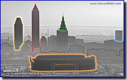
August 27 - September 2, 2012 "Gray vs. Neon" Two of the most important things we have to consider when getting beautiful, colorful aerial photographs are the air quality and the position of the sun. When the air is hazy and we are looking into the sun (either directly or just in the general direction), it is the worst of both worlds as far as rich and nicely saturated colors go... This aerial photo of Cleveland Browns Stadium was taken on a hazy winter day. There was virtually no hope of bringing back the color in this image, so we opted to go the opposite direction and take what little color there was out and make it a black and white photo. The effect makes it seem like the photo was taken a long time ago. We also decided to play around with the image and add some color in a more artistic way and a few other effects. Which do you prefer? The black and white or the "neon" version? (Or, do you prefer a traditional color photo like this one?) We'd love to hear from you - drop us a line and tell us what you like (or don't like!).
To view larger versions of these photos, click on them or click one of these
links:
|
|
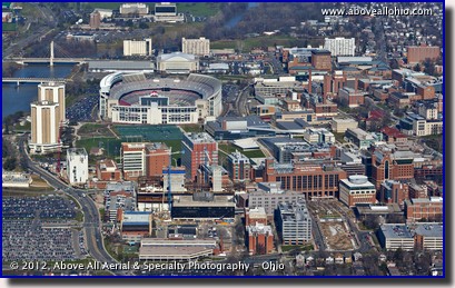
August 20-26, 2012 "Short Break" The Buckeyes had a particularly short summer this year as The Ohio State University made the transition from a quarters-based academic calendar to one based on semesters. The change was made to better align the school's calendar with the majority of other state schools. Students start classes this week in Columbus. At first glance, this photo of Ohio Stadium, the hospitals, and a large part of the campus may look like a nice sunny summer photo. Active construction sites, green grass, and the Olentangy River's blue water are all clearly visible. However, a closer look will reveal the lack of leaves on any of the trees, shattering the illusion of a warm summer day. This low angle oblique was taken just after New Year's Day as what would become one of the mildest Ohio winters on record was just getting started. With that in mind, perhaps the summer didn't seem that short for students after all... To view a larger version of this photo, click on it or click this direct link. |
|
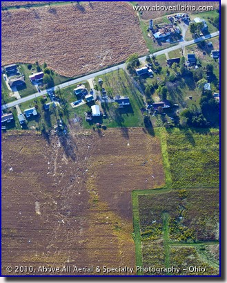
August 13-19, 2012 "Tornado Damage" According to the Tornado Facts page of Ohio's state website, "Peak tornado season in Ohio is generally April through July..." However, tornadoes can hit any day of the year (and any time of the day). This photo was taken in September of 2010, near Wooster, Ohio, after a small tornado struck east of the city (one of 13 to hit the state that month). In this photo, a destroyed barn can be seen in the upper right hand corner. The tornado then appears to have taken the roof off of a garage across the street and to the left. It then apparently stripped several trees of their leaves and caused significant damage to one house while leaving two others nearly untouched. The debris from these damaged buildings can be seen scattered through the field in the lower half of the photo. To view a larger version of this photo, click on it or click this direct link. |
|
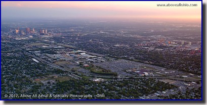
August 6-12, 2012 "The Sun Sets on the 2012 State Fair" The last day of the Ohio State Fair was August 5 and featured a concert by country music star Jason Aldean. The concert was held at the Columbus Crew Stadium, which is north of the main fairgrounds and visible in the lower right portion of this photo. After storms pushed through Ohio earlier in the day, fair and concert goers were treated to cooler air. We were treated to clean air, awesome skies, and a beautiful sunset. Downtown Columbus can be seen in the upper left corner of this photo, near the horizon. The campus of The Ohio State University is in the middle of the photo on the right edge. Ohio Stadium and the two dorms that are Lincoln and Morrill Towers stand out as landmarks on the northwestern corner of the main campus. To view a larger version of this photo, click on it or click this direct link. |
|
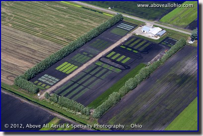
July 30 - August 5, 2012 "Experiment Station" Neatly outlined by protective, wind-breaking trees, this unusual plot of black "muck" lies just south of Celeryville, Ohio, in Huron County. Once known as the Ohio Agricultural Experiment Station, it is now known as the Muck Crops Agricultural Research Station and is part of The Ohio State University's OARDC, or Ohio Agricultural Research and Development Center. There are 11 other locations throughout the state. The soil in this area is black because it consists of approximately 45% organic matter. This high organic content is due to the fact that this land was swampland until Dutch immigrants drained it with a series of canals, tiles, and dams in the late 19th century. The fine soil is ideally suited for growing the vegetables that the area is known for. It also presents unique challenges for farmers, which in turn provides unique opportunities for Ohio State's researchers. To view a larger version of this photo, click on it or click this direct link. |
|
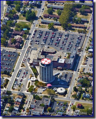
July 23-29, 2012 "X Marks the Spot" More accurately, the top of the unusual, cylindically-shaped tower is covered by a "plus sign" or medical cross, not an "X", but you get the idea... More importantly, pilots of emergency medical helicopters get the idea of this high visibility, red-and-white landing area! Helipads save lives. When seconds matter in life-and-death situations for critcally injured or ill patients, the ability to land directly at a primary care hospital is often the difference between survival or fatality. This particular helipad and hospital - University Hospital East - is part of The Ohio State University's renowned hospital network. It is located a few miles east of downtown Columbus, Ohio. The other unusually shaped building (an octagon) that can be seen below and to the right of the main tower, is Buckeye Radiation Oncology. To view a larger version of this photo, click on it or click this direct link. |
|
July 16-22, 2012
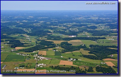
"Ohio Summer" Just in case our fellow Ohio residents have forgotten how beautiful summer normally is in our state, here is a little reminder... The worst drought in decades has struck a lot of the country and the view from above the past few weeks is very different than this view, taken at the end of June, 2010. Whereas this scenic landscape photo has a lot of green fields and green grass (and some light brown fields where winter wheat was recently harvested...), we are currently seeing a lot of thin trees and fields and yellow grass. We never like to turn down work here, but we have been advising our customers and potential customers that if they want "beauty shots" for their marketing efforts or their home or office decor, it is really in their best interest to wait until things green up again. Since August is usually a dry month even in a normal year, we don't expect that to happen until mid to late September. Incidentally, we are definitely going to be very busy when it happens - if you are on the fence about ordering photos, we encourage you to go ahead schedule your photos now while we have room in the schedule! If you decide to cancel later, that's OK - we do not charge a booking fee or penalty fee or any other kind of fee if you need to cancel! To view a larger version of this photo, click on it or click this direct link. |
|
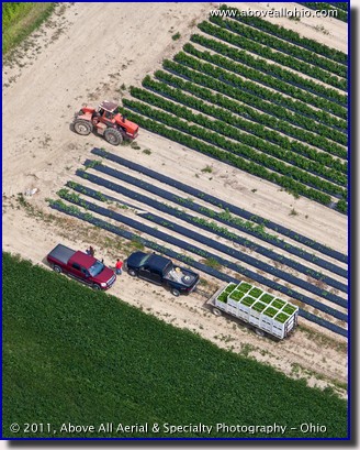
July 9-15, 2012 "Outstanding in Their Field" We happened to be flying over a field in north central Ohio when two farmers were discussing their recently harvested crop of green peppers. The wagon attached to the black pickup truck is loaded with 22 bins full of fresh green peppers. Each bin is about 4' x 4' x 4' and contains enough peppers to fill 20-22 boxes (22-25 bushels). The bins will be taken to Doug Walcher Farms, a grower near North Fairfield, Ohio, where they will be unloaded. The peppers will be washed, sanitized, sorted (by color and size), graded, and packed at a brand new, state-of-the-art packing facility (built in 2011). From there, these Ohio grown green peppers will be sold, distributed, and enjoyed throughout the eastern half of the United States. To view a larger version of this photo, click on it or click this direct link. |
|
July 2-8, 2012
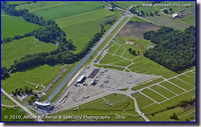
"Drag Strip" National Trail Raceway is located in Licking County, Ohio, just east of Columbus, and just north of Interstate 70. The track has billed itself as "The World's Fastest Quarter-Mile" ever since Tony Schumacher set an NHRA National Speed record when he hit 336.15 miles per hour at the track in May, 2005. Though it still hosts smaller NHRA events, the track is no longer host to Top Fuel national events. Ohio fans wishing to see the awesome Top Fuel dragsters can now go to the Summit Motorsports Park, about 95 miles straight north of this track in Norwalk Ohio. The Top Fuel event is this week, July 5-8, 2012. Perhaps we will feature an aerial photo of that venue in the future - stay tuned! To view a larger version of this photo, click on it or click this direct link. |
|
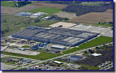
June 25 - July 1, 2012 "Stamp of Approval" This former General Motors Stamping Plant in Ontario, Ohio, is awaiting redevelopment by one of at least two interested parties. Several details need to be worked out before local authorites give their "stamp of approval" but hopes are high in the Mansfield area that a deal can be reached quickly. One developer has promised to turn the plant into a multi-tenant facility that could provide 1,130 new jobs for the area over the next several years. The plant has been vacant since it closed in early 2010 due to GM's bankruptcy and subsequent cost-cutting and reorganization. The plant had been operating since the mid-1950's. To view a larger version of this photo, click on it or click this direct link. |
|
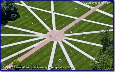
June 18-24, 2012 "Catching Some Rays" Normally a much busier part of campus, the criss-crossed center of "The Oval" at The Ohio State University's main campus in Columbus is almost deserted during the summer quarter. (On a side note, we understand that Ohio State is transitioning from its quarter-based academic calendar to the more common semester-based calendar starting this year.) Though some might say that these paths lead inward to a meeting place in the middle of campus, from our vantage point, the paths clearly resemble the rays of the sun. (Of course, it could be that our opinion is influenced by the presence of the sun-bathers who are dotting the grass between the paths...) However you see it, we thought this was another good example of the neat patterns we can see from the air that can't be seen from the ground. To view a larger version of this photo, click on it or click this direct link. |
|
June 11-17, 2012
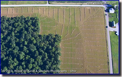
"Harvest Patterns" You might not think of June as "harvest time," but it actually is... Winter wheat is planted in the fall and becomes established before the winter weather sends it into a dormant state, just like grass. The warm spring weather gets the wheat growing again and it is ready to harvest in June. Although most farmers use combines and other machinery to harvest their wheat, a large population of Amish farmers in Ohio uses horse-drawn implements to get the job done. (You might be able to make out the horse- drawn buggy on the road at the top of this photo, just right of center...) After the wheat has been cut, the straw is gathered into bales and laid out in neat patterns across the field as can be seen in this late-afternoon aerial photo. Later, the bales will be picked up and stored in barns for use throughout the year. To view a larger version of this photo, click on it or click this direct link. |

|
June 4-10, 2012 "Car Show Close Up" Although we still have a couple more weeks before the official start of Summer, Memorial Day weekend does tend to get us thinking about summer and the many great outdoor activities that go along with the season. This car show near Youngstown took place a few years ago, near the end of the summer. We took many views of the event, but this close-up was one that really seemed to capture the spirit of the event. There are a lot of classic vehicles visible - painted in many different colors, waxed until they shine like a mirror, with their hoods propped up - while people mill about admiring them and recalling the early days (glory days?) of the automobile. Proud owners can be seen sitting near their vehicles, some under equally colorful umbrellas, more than willing to both chit-chat and go into deep mechanical discussions with anyone willing to take the time. If you have a special event going on this summer, give us a call and let us document it from our unique perspective! Aerial photos can be given to participants, large prints can be awarded as memorable prizes or sold as fund-raisers, and digital files can be used to create attention-grabbing promotional materials for future events. Don't wait until the last minute - scheduling for date and/or time specific aerial photo shoots can be a bit tricky! To view a larger version of this photo, click on it or click this direct link. |
|
May 28 - June 3, 2012
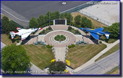
"Phantoms" Although this is not a "memorial" per se, we thought it would make a fitting tribute for Memorial Day to feature the Marjorie Rosenbaum Plaza at Burke Lakefront airport in downtown Cleveland, Ohio, as this week's Stock Photo of the Week. The jets featured in the plaza are F-4 Phantoms. This versatile fighter jet is the only one to be used by both the Blue Angels and the Thunderbirds, the U.S. Navy's and the U.S. Air Force's flight demontstration teams, respectively. We hope that this Memorial Day weekend, amidst the family gatherings and backyard barbeques, everyone takes a moment to remember the men and women of the miltary that gave the ultimate sacrifice for our freedom. To view a larger version of this photo, click on it or click this direct link. |
|
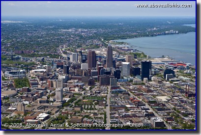
May 21-27, 2012 "Cleveland from the East" We have a lot of stock photography of downtown Cleveland, Ohio. We have close ups, wide angle views, panoramic views, and some non-traditional "artsy" views. This wide-angle, aerial view of Cleveland is more of the traditional variety, but this view looking west is not one that people see very often for some reason. We came across it in our archives and thought we would share it this week. This photo was taken in the late morning light exactly 4 years ago this week - on May 23, 2008. At the edges of the photo are Cleveland's two outdoor professional sports stadiums - Progressive Field to the left (south) and Cleveland Browns Stadium to the right (north). The two stadiums are almost exactly 1 mile apart. The light colored area, visible just below the horizon on the extreme left edge of the photo, is Cleveland Hopkins International airport. It lies about 9 miles southwest of downtown. To view a larger version of this photo, click on it or click this direct link. |
|
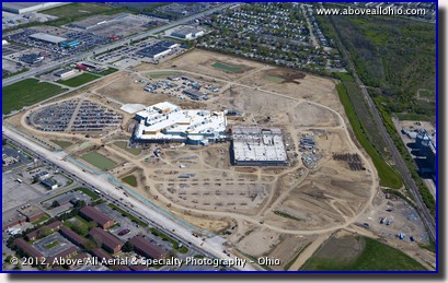
May 14-20, 2012 "Columbus Casino Construction" On November 3, 2009, Ohio voters approved "Issue 3" which ammended the Ohio state constitution and allowed one casino to be opened in each of Ohio's four largest cities (Cleveland, Cincinnati, Columbus, and Toledo). More than two and a half years later, the first of these casinos - The Horseshoe Casino Cleveland - is slated to open today, May 14, 2012. The Hollywood Casino Toledo is set to open later this month. This week's photo, however, is not of either of those two casinos. This aerial aerial photo is of the Hollywood Casino Columbus which is under construction a few miles west fo downtown Columbus. As you can see from this overall bird's eye view, much work has been completed, but there is still much more to be done. This casino is scheduled to open late this year. Keep checking back with us - we will get another photo closer to the grand opening! To view a larger version of this photo, click on it or click this direct link. |
|
May 7-13, 2012
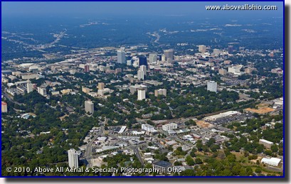
"Far from Home" We here at Above All - Ohio naturally spend the majority of our flying time above Ohio and the surrounding states. Sometimes, however, we are able to string together a bunch of sites in various locations and we can work our way to more distant sites while keeping the costs affordable for everyone. This week's photo is of downtown Columbia, South Carolina. A site we flew here is the most distant one we have flown ourselves to date. However, that was not the most distant site that we have obtained photos of for our clients. Through our network of professional aerial photographers, we regularly provide photos of distant sites. We know the best photographers all over the country - we tell them what, where, and how and they get the "raw" images for us. We then do the post-processing so that our customers - with one phone call - can order several sites and be assured that all of the photos will be nice and consistent when they get them. This week, we want to wish all of the mothers out there a very HAPPY MOTHER'S DAY - whether their children are with them or far away from home! To view a larger version of this photo, click on it or click this direct link. |
|
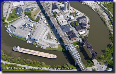
April 30 - May 6, 2012 "Going Around the Bend" Our aerial vantage point gives us some unique opportunites to see things from a perspective that most people don't get a chance to see them from. This huge freighter is maneuvering around a tight bend in the Cuyahoga River in downtown Cleveland. It is a slow process and gives us appreciation for our ability to fly in a straight line from point A to point B! (Of course, it would take us thousands and thousands of trips to carry the amount of cargo that this ship can carry in in just one trip...) To view a larger version of this photo, click on it or click this direct link. |
|
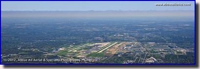
April 23-29, 2012 "Cloud Deck Over Columbus" The line of clouds seen in this panoramic aerial photo is not actaully over the Port Columbus Airport; the skies above Columbus (Ohio) on this day were nice and clear. This huge, low, solid overcast layer of clouds extended over eastern Ohio and western Pennsylvania making a large part of our normal service area unsuitable for aerial photography on this particular day. Keeping tabs on the weather means more than just looking out of our office window or watching the local news. Above All - Ohio is owned and operated by a former National Weather Service meteorologist, so we have a better grasp on the weather than most other photographers (aerial or otherwise). Understanding the complex variables involved and monitoring the weather forecasts in all of the markets that we serve helps us optimize our flight schedule. As full-time, professional aerial photographers, we are not bound by other people's schedules; we can adapt to weather changes quickly, ensuring that our customers get their photos as quickly and as efficiently as possible. To view a larger version of this photo, click on it or click this direct link. |
|
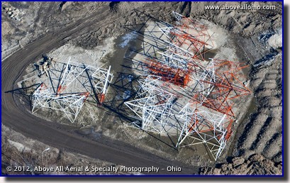
April 16-22, 2012 "Giant Erector Set" These pieces of steel trusses, seemingly just dumped out onto the ground, will soon be assembled into a new radio tower near downtown Columbus, Ohio. From the looks of the pile, it does not appear that it will be a particularly tall tower, but we will definitely be on the look out for it from now on! Towers pose a hazard to low flying aircraft such as ours when we are flying photo missions, but they are generally not a problem for us. We tend to stay 1.5x the distance that the FAA requires us to stay above the ground and away from obstacles such as these for an extra margin of safety. To view a larger version of this photo, click on it or click this direct link. |

|
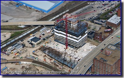
April 9-15, 2012 "Cleveland's Medical Mart and Convention Center" The Flats isn't the only place in downtown Cleveland that is undergoing new development. The Cleveland Medical Mart & Convention Center project is also keeping construction workers in northeast Ohio busy. The Medical Mart will will consist of 235,000 square feet of rooms which will showcase all kinds of technology and devices related to the healthcare industry. The conference center will have 230,000 square feet of exhibit space, 90,000 square feet of meeting rooms, and a 30,000 square foot Grand Ballroom. The facility is expected to open in the second half of 2013. To view a larger version of this photo, click on it or click this direct link. |
|
April 2-8, 2012
"The East Bank at the Flats" The Flats East Bank project along the shore of Lake Erie in downtown Cleveland is well underway as can be seen in this close up aerial view. The first phase of the project, which aims to fully develop the east bank of the Cuyahoga River where it empties into Lake Erie, will include an environmentally friendly ("green"), state-of-the-art office building as well as a 150-room hotel. The first businesses are scheduled to open in 2013. To view a larger version of this photo, click on it or click this direct link. |
|
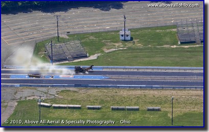
April 1, 2012 "One Horsepower Dragster" The annual "One Horsepower Drag Buggy Races" is a little known event outside of the Amish communities in Ohio. Held on the first of April each year (before the spring planting season gets underway in earnest), the event is virtually ignored by the mainstream media and little is known about it. We do know that the event draws a significant crowd - we can't fly within 3 miles of this location on race day due to a TFR (Temporary Flight Restricition) that affects all outdoor sporting events with 30,000+ spectators. We just happened to be flying by Dragway 42 (near West Salem, Ohio - and very near Ohio's "Amish Country") where this event and other events are held, during a test session for this horse and drag buggy. Due to the intense competition, these test sessions are normally conducted in secrecy; so secret, in fact, that most people will deny that they even take place. To view a larger version of this photo, click on it or click this direct link. |
|
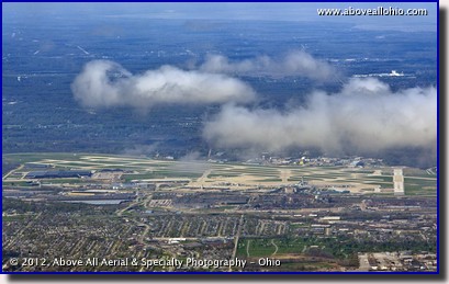
March 26-31, 2012 "CLE Under Clouds" Cleveland Hopkins Airport appears to be under some low cumulus clouds in this spring time photo. Actually, the clouds are just much closer to the camera (about 2 miles away) than the airport (more than 10 miles away). Winds coming out of the north caused these clouds to form above Ohio's north shoreline - as the air moved from the relatively smooth and thermally stable Lake Erie, it hit the bumpy and unevenly heated terrain causing the moisture to condense and become visible. Further south on this particular day, the clouds disappeared completely from the sky. Sometimes the weather and seasonal conditions are reversed and the skies over the areas adjacent to the lake remain clear and the clouds pop up a few miles inland. To view a larger version of this photo, click on it or click this direct link. |
|
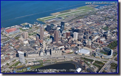
March 19-25, 2012 "Cleveland Heights" This wide angle aerial view of downtown Cleveland, Ohio, and Lake Erie was taken in 2007 when the Terminal Tower (just below and left of the center of the image) was still undergoing restoration. The dark scaffolding is visible around the top of the structure. This image is a somewhat difficult one to obtain - we had to be in the airspace normally reserved for large passenger jets arriving into and/or departing from Cleveland Hopkins airport. Fortunately, the air traffic controllers in Cleveland are great to work with and do their best to accomodate our requests when we need to be in their airspace. Proper advanced planning, notification, and professional communication are essential for safety reasons in busy airspace. If you have a site near a major airport that you need photos of video of, be assured that we can get the job done, but please know it will take a little extra time and effort to make the proper arrangements. To view a larger version of this photo, click on it or click this direct link. |
|
March 12-18, 2012
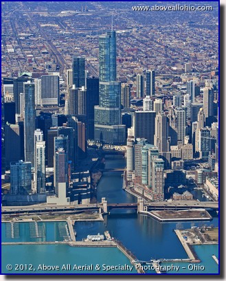
"A Usually Blue River" The dark blue Chicago River in front of the recently constructed Trump International Hotel and Tower is due to be turned green on Saturday morning as is the St. Patrick's Day tradition in Chicago. The Chicago River empties into Lake Michigan (the lighter, blue-green water in this photo) in downtown Chicago between the Sears Tower (sorry, Willis, it will always be the Sears Tower to me...) to the south (left of this photo) and the John Hancock Center to the north (right of this photo). Stay tuned to this page - later in the year, we will feature another view of downtown that shows all of the famous Chicago skyscrapers! To view a larger version of this photo, click on it or click this direct link. |
|
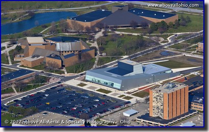
March 5-11, 2012 "Nordic Architecture in Ohio" The new steel-gray Wolf Center for the Arts on the campus of Bowling Green State University in northwestern Ohio stands out among the brown-brick buildings that make up most of the rest of the campus. Designed by the noted Norwegian architectural firm Snøhetta, the $31 million building opened last December after approximately two years of construction. To the left of the Wolf Center is another architecturally interesting building - the Moore Musical Arts Center. The tall building at the lower right with the intricate mural is Jerome Library. To view a larger version of this photo, click on it or click this direct link. |
|
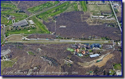
February 27 - March 4, 2012 "Fly-In Resort" The wood in some of the 2,000 wooded acres surrounding the Nemacolin Woodlands Resort in Farmington, Pennsylvania, really stands out in this mid-spring aerial photo. With no leaves on the trees, roads and land features are also clearly visible from the air. This is the main reason that March and April are very busy months for aerial photographers (such as us...) in the northern states who provide aerial mapping services. Many counties and other government agencies take advantage of the season to update their photographic tax and property maps. Perhaps we can land at this luxury resort's private airstrip someday and stay for awhile. Hopefully, we can do it in the summer or fall months so we can get some spectacular "beauty shots" of the resort and surrounding areas while we're there! To view a larger version of this photo, click on it or click this direct link. |
|
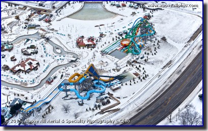
February 20-26, 2012 "Toboggan Chutes?" The water slides at Zoombezi Bay Waterpark, located on the northwest side of Columbus, Ohio, look more like a collection of toboggan chutes in this icy aerial view we captured last winter. The near vertical summer view of the park that we featured in 2010 probably makes the park look much more inviting than this oblique aerial view taken last Februay does. However, just because these slides and pools are iced over and covered in snow, winter waterpark fun in Ohio is definitely not out of the question. Check out aerial photos of America's largest INDOOR waterpark here and here! To view a larger version of this photo, click on it or click this direct link. |
|
February 13-19, 2012
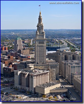
"The Terminal Tower Stands Alone" The Terminal Tower, downtown Cleveland's landmark skyscraper, seemingly stands alone in this somewhat uncommon view looking east/southeast from a helicopter. The iconic building means many things to many people in northern Ohio. Personally, whenever this photographer sees it, I can't help but think of my great-grandparents who set out on a ship from the Netherlands with four very young children in 1896. They arrived at Ellis Island in New York City in September of that year, then took a train to Ohio -- arriving at this very building. It may seem crazy that entire families would leave their homes to seek out a new and better life in a foreign country, but the romance of the adventure is certainly not lost on me this Valentine's Day... To view a larger version of this photo, click on it or click this direct link. |
|
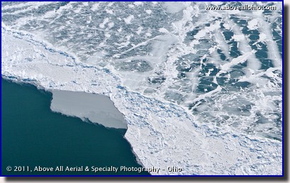
February 6-12, 2012 "Lake Erie Ice" The unusually mild winter here in the midwest means that we are unlikely to see ice covering Lake Erie as we did last winter when this photo was taken. As it is the most shallow of the Great Lakes with an average depth of only 62 feet, ice is certainly not an uncommon sight on Lake Erie. Local WJW FOX-8 meteorologist Scott Sabol put together a nice set of graphics comparing last year's ice coverage with this year's in a blog entry last month. Check it out and find out how the ice coverage (or lack thereof...) affects northern Ohio's lake effect snow as well! UPDATE: Here is another of Scott's blog entries, updated February 14, 2012, with even more statistics: Scott Sabol's World of Weather To view a larger version of this photo, click on it or click this direct link. |
|
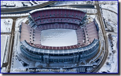
January 30 - February 5, 2012 "Ice Bowl" The Cleveland Browns football team has won a total of four league championships in its history, dating back to 1946. Unfortunately, this aerial view of a cold and icy Cleveland Stadium pretty much sums up the Browns' history since their last championship in 1964. Although they've had a few seasons where they came within one win of a trip to "the big game," they have been frozen out of it since 1964 - 3 years prior to the first year the game was billed as the "Super Bowl." One of our sister offices is located in Indianapolis - site of this year's championship game. If you need stock photos or video of the downtown area, please give us a call! We will have broadcast ready HD aerial video and very high resolution photos available! Update: Here is a link to some sample stock footage, acquired just prior to the game: Pre-game crowd To view a larger version of this photo, click on it or click this direct link. |
|
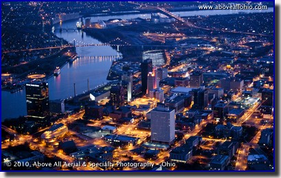
January 23-29, 2012 "Glass City at Night" Downtown Toledo, Ohio, and the Maumee River shine in this night time aerial photograph. Night time aerials are a very tricky assignment - slow shutter speeds combined with a camera moving in excess of 100 miles per hour make it very difficult to get great images. We use top-of-the-line cameras and lenses as well as gyro stabilization to get the best photos possible for our customers. Give us a call today to discuss your most challenging projects! We can help! To view a larger version of this photo, click on it or click this direct link. |
|
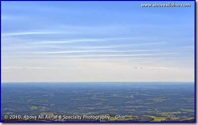
January 16-22, 2012 "Atmospheric Rumble Strips" We're usually pointing the camera at things on the ground while we're in the air, but sometimes it's worth turning the lens towards the sky... We noticed these interesting clouds early last summer while flying over rural eastern Ohio. Clouds like this are too high for our piston-engine powered airplane to reach. That's fine with us, though - patterns like this usually indicate some kind of turbulence in the atmosphere. To view a larger version of this photo, click on it or click this direct link. |
|
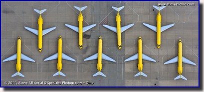
January 9-15, 2012 "Airport Parking" The bright yellow fuselages of cargo carrier DHL's planes stood out from a distance, so we decided to go take a closer look. This near vertical panoramic photo shows how airplanes are parked on the ramp (often incorrectly referred to as the "tarmac"). This arrangement allows the planes to use the available real estate more efficiently. To view a larger version of this photo, click on it or click this direct link. |
|
January 1-8, 2012
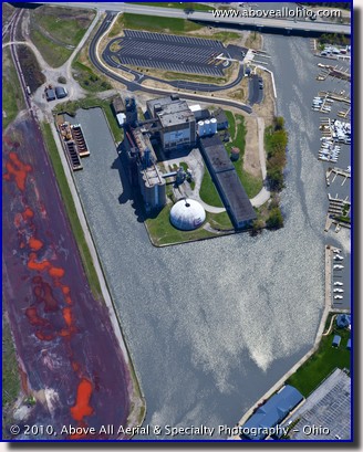
"Starting the Year with a Bang" In 2007, we closed out our Stock Photo of the Week gallery with a bang. This year, the city of Huron, Ohio, started their year with a bang. (Fortunately, Huron's explosion was planned...) This building, formerly owned by Con-Agra and a very visible landmark in the city, sat along the Huron River where it empties into Lake Erie. The city decided to raze the building to make room for new development along the shore. Perhaps the most interesting aspect of this implosion was that seven-year-old Max Hinton, a youg man from California who suffers from neuroblastoma, was chosen to push the button to bring down the granary through the Make-A-Wish foundation. More information, including video footage of the implosion can be found here and here. To view a larger version of this photo, click on it or click this direct link. |
|
|
||

2011 |

> 2012 < |

2013 |
|
|
||


